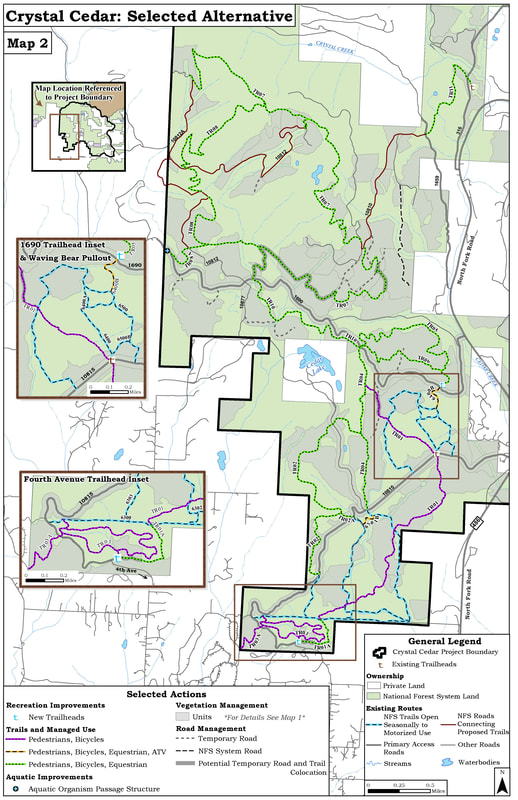
The Crystal Cedar Project is a forest management project undertaken by the Forest Service for the area to the north of Columbia Falls. The project area is the federal land that lies between the North Fork Road to the east, Trumble Canyon Road to the west, and Canyon Creek / 316 Road to the North.
The project received final approval from the Forest Service in March, 2020, with a total of 25 miles of new trail approved. FAMB submitted comments supporting these trails. We also requested additional trails in specific locations that would improve the network. The project includes both forestry components (commercial logging as well as fuels reduction) as well as recreation components.
You can read the full environmental analysis of the project on the USFS website, and to read the final decision, click here.
A map of the approved trails appears below, and you can view a map of the planned logging here.
We'll begin building trails and trailheads as soon as we can, and will be working in partnership with Gateway to Glacier Trails and other interested groups every step of the way. We may start on some portions of the project as soon as this summer, but some of the trails won't be built until the logging is completed, which will likely take 3-5 years. We'll be able to start building trails incrementally as portions of the logging project are completed.
As always, building these trails will take a lot of time, effort, and money. Watch for FAMB fundraising efforts in the future so we can get these trails built and open!
Preserving and advancing mountain bike activities in the Flathead Valley.
© 2022 Flathead Area Mountain Bikers | All Rights Reserved


